- Rapport
- Vattenkraft
Geomatics for Improved Flood Risk Management
Many people are living in flood risk areas and the problems associated with the hazards as well as the solutions are essentially spatial in nature.
Rapporter och publikationer
Här listas rapporter och resultatblad från programmet.
- Rapport
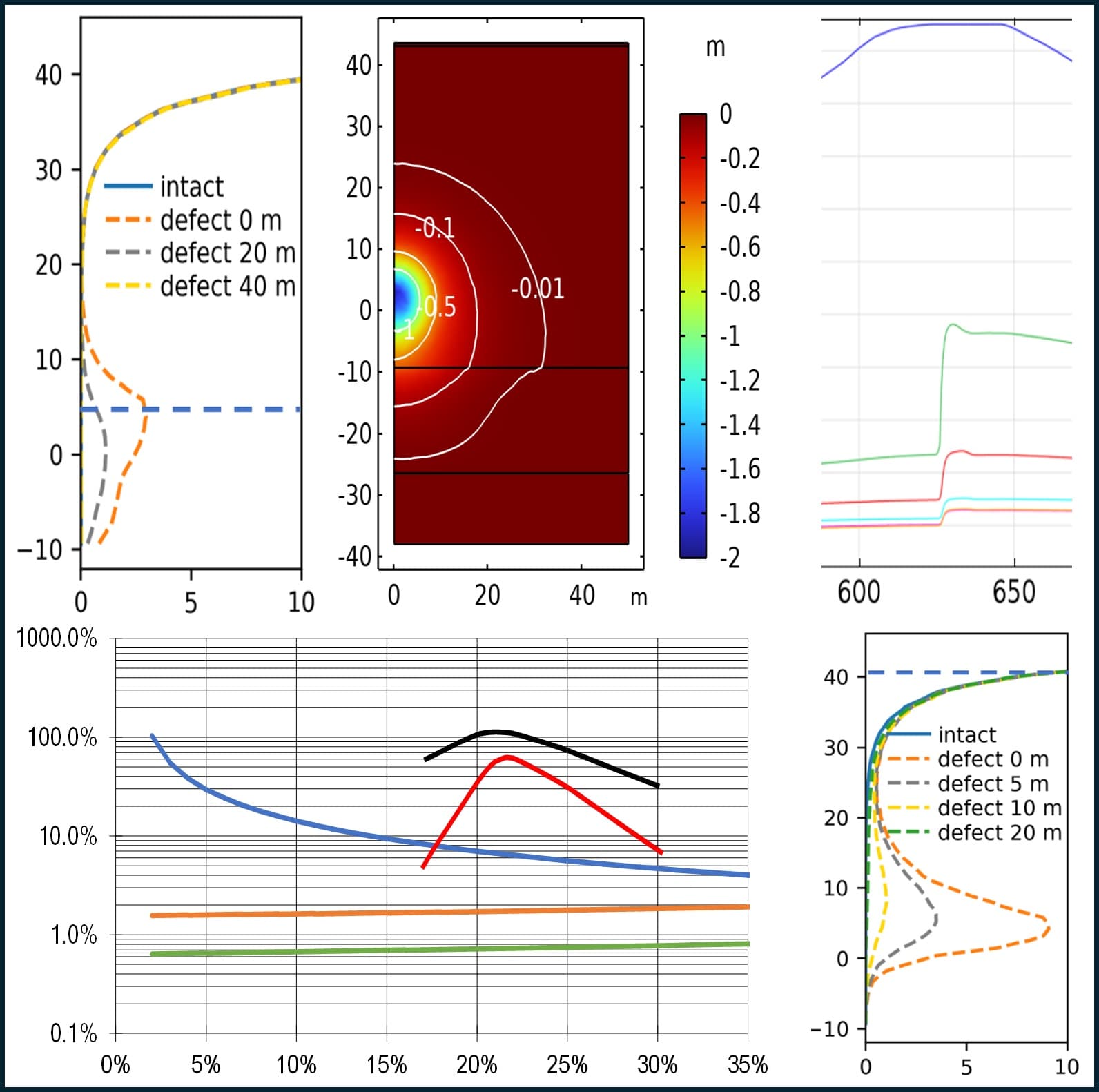
Statusbedömning av injekteringsridåer
Injekteringsridåer är en viktig del av dammkonstruktionens tätskikt, med uppgift att begränsa vattenläckage och minska upptryck i berggrunden. Som en del av arbetet med att försäkra dammsäkerheten behövs tillförlitliga metoder för att bedöma injekteringsridåns effektivitet, vilka beskrivs i den här rapporten.
|2026:1174Yanting Chang, Hans Fridholm, Benny Mohlin, Ingrid Kjellström SWECO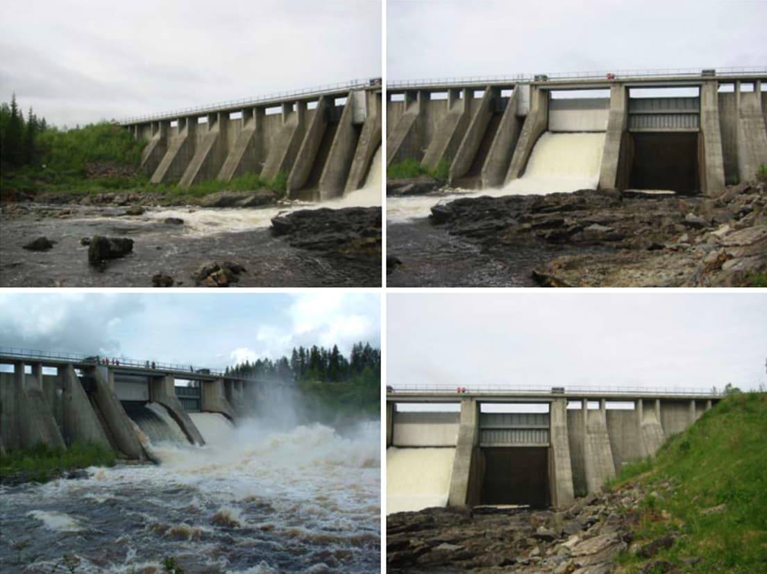
- Rapport
Statusbedömning av komponenter för manövrering av utskovsluckor
Det här projektet har sammanställt olika metoder för att bedöma status på utskovsluckors olika komponenter. Att bedöma de mekaniska komponenternas skick och kvarvarande livslängd kan minska risken för utebliven manövrering eller oavsiktlig stängning av en utskovslucka och därmed också öka dammsäkerheten vid dammanläggningen.
|2026:1153Patrik Bennerstedt, Love Ekström, Andreas Halvarsson WSP
- Rapport
Documentation from the dismantling of the Älvkarleby test embankment dam
The Älvkarleby test dam was built in 2019 and served as a national and international test bed until the fall of 2024. After 4.5 years of operation, the dam was dismantled and thoroughly documented. The dismantling process revealed multiple instances of internal erosion, including signs of material displacement and seepage pathways, indicating potential vulnerabilities in the dam’s structural integrity.
|2026:1150Johan Lagerlund och Saima Riaz, Vattenfall R&D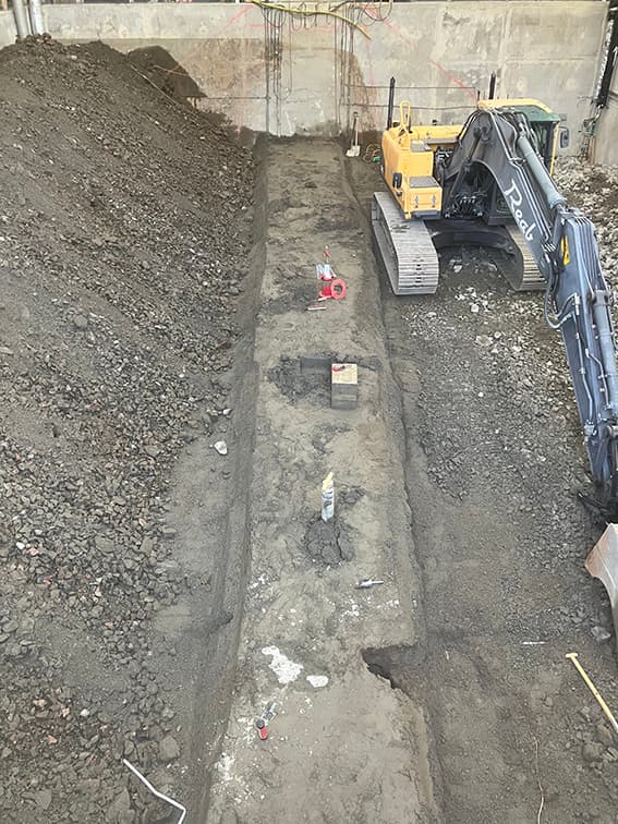
- Rapport
Vägledning för mätning och utvärdering av dammars funktion
Dammars säkerhet är i ständigt fokus. Den här rapporten visar tydligt hur viktigt det är att ha en helhetssyn vid övervakning av dammar. Grundläggande är en god förståelse för dammens behov, samt kompetens att kunna välja bäst metodik för att upptäcka och följa förändringar. Mätningar måste hålla hög kvalitet så att man kan lita på mätdata vid tolkning och analys.
|2025:1125Sam Johansson, Magnus Ljunggren, Peter Viklander